Quick version
Features which you would be expected to identify on an OS map of coastal areas are:
- cliffs: tightly packed contour lines and bare rock symbol, or named example.
- caves: shown by the word cave or caves or a named example.
- stacks: small outcrops of rock which are separate from a headland.
- arches: sometimes named and the words natural arch may also appear.
- headlands and bays: outcrops of harder, more resistant rock found jutting out into the sea on either side of the bay.
- sandspits: often have curved or hooked ends with marshland behind.
- sandbars: when two headlands are joined by sand, leaving a lagoon behind.
Identifying cliffs on an OS map
 Image source, Dukas / Getty images
To identify a cliff at the coast, you are looking for very tightly packed contour lines to indicate a rapid change in height of the land.
You will often find the bare rock symbol, small black triangles indicating a slope and sometimes the scree symbol to show that there is loose fallen rock.
Sometimes the cliff will be named, for example Gad cliff is named in this map extract.
Image source, Dukas / Getty images Image source, Contains OS data © Crown copyright 2026
Identifying caves on an OS map
 Image source, Arterra / getty images
Caves are easy to identify on a map as they often have the word cave as shown on the map extract.
Caves/caverns are often located in an area of exposed rock, often a headland with more resistant rock.
Image source, Arterra / getty images Image source, Contains OS data © Crown copyright 2026
Identifying arches on an OS map
 Image source, Eye Ubiquitous / Getty images
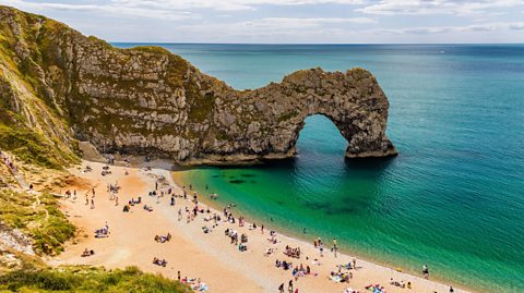
Where a headland is very exposed caves may be eroded through the headland to form an arch.
Arches are sometimes named on an OS map and the words (Natural arch) may also appear.
Image source, Eye Ubiquitous / Getty images Image source, Contains OS data © Crown copyright 2026
Identifying stacks on an OS map
 Image source, Epics / Getty images
Stacks are characterised by small outcrops of rock which are separate from a headland.
They are often named as per the example of Old Harry on the map extract.
Image source, Epics / Getty images Image source, Contains OS data © Crown copyright 2026
Identifying headlands and bays on an OS map
 Image source, David Goddard / Getty images
Headlands and bays can be identified on a map based on their shape. A bay is shown by the coastline curving inwards. A bay will often be named, like Durlston Bay shown on the map extract.
Headlands are outcrops of harder, more resistant rock found jutting out into the sea on either side of the bay.
These often have names that include the word head, like Durlston Head, or ‘point, like Peveril Point, shown on the map extract.
Image source, David Goddard / Getty images Image source, Contains OS data © Crown copyright 2026
Identifying sandspits and sandbars on an OS map
 Image source, Finnbar webster / getty images
Sandspits form where there is a change in the direction of the coastline, but longshore drift has continued to deposit material out into the sea.
Many sandspits are narrow features, following the direction of the coastline and often have curved or hooked ends due to changes in wind direction. You will often find marshland behind a sandspit.
Sandbars are formed where longshore drift moves the material across a bay and two headlands are joined. This often leaves a body of water known as a lagoon behind the sandbar.
Image source, Finnbar webster / getty images Image source, Contains OS data © Crown copyright 2026
Recap
Features which you would be expected to identify on an OS map of coastal areas are:
- Cliffs: tightly packed contour lines indicate rapid change in height of the land. Often small black triangles indicating a bare rock slope.
- Caves, arches and stacks: often named and located in an area of exposed rock, a headland with more resistant rock,
- Headlands and bays: outcrops of harder, more resistant rock found jutting out into the sea on either side of the bay, often named.
- Sandspits: form where there is a change in the direction of the coastline, but longshore drift has continued to deposit material out into the sea. Narrow features with curved or hooked ends. Often find marshland behind
- Sandbars: where longshore drift moves the material across a bay and two headlands are joined. Leaves a body of water known as a lagoon behind the sandbar.
More on Coastal landscapes
Find out more by working through a topic
- count1 of 5
- count2 of 5
- count3 of 5